

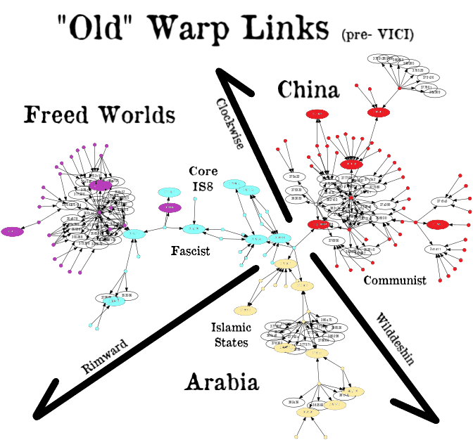
I used the actual map of stars in our local arm of the Milky Way. When I did this, I used ChyView and 250ly range. The major players on Earth at the time were Democracy, Communism, Catholicism, Islam, with pockets of Fascism.
Purple – nominally Empire, Democracy for all Citizens, front: re-exploration
Blue – strongly Empire, fascists, Democracy for the Gentry only, build: fleets to grab taxes
Yellow – strongly Islamic, Democracy for the Gentry only, warfront: Mechs [active]
Red – Communism, Big Brother, warfront: Bugs [stalled – holding positions]
Every dot is a base of something, every oval has planets, lines connect ‘easy jumps’. (I brought this back to ‘simplify’ viewpoint) From Sol at center, left 255ly to Boros Sector on the fringe.
We have Old “Warp Drive” Warships (jumps that caused new filaments and sparked a war); “Folding” Guildships (a mythos-driven low-time dilation jump); “Stringing” Ringships (grasping onto existing sub-space filaments). So I get to use a calculator each time they want to move large distances (say Saturn to Jupiter during opposition – takes 5 day or you can blast your way there in about two years.) (I built this before MoSh expanded)

You must be logged in to post a comment.